
Features Tortie GPS
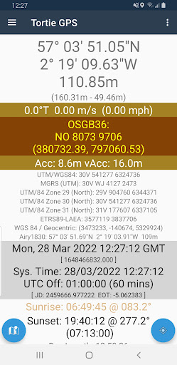
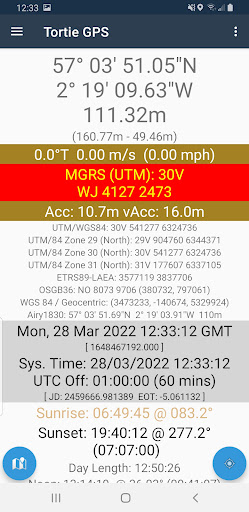
A no-frills, slightly quirky, GPS navigation helper tool which shows the current GPS-derived position of your device in coordinate reference systems relevant for your current location (e.g.
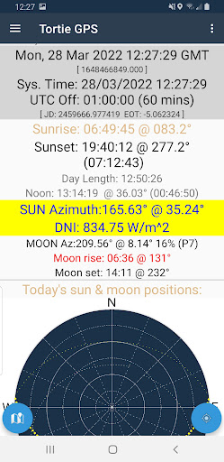
for the UK these would include OSGB36, three UTM on WGS84 zones, MGRS, ETRS89-LAEA and Airy1830).Also shown are the sun and moon locations throughout the current day, very useful when visible for orienting both yourself and solar-dependent equipment such as solar panels.And finally, this simple app allows waypoints and tracks to be created and written to file in the standard GPX format, provided youve given permission for this.
No file system access other than this is performed.(Note that not all SRSes displayed are necessarily vaild for your location; for example the British National Grid covers all of eastern Ireland but this grid is valid only within the British Isles and so in Ireland its informational only.)
Gaming Features
Enjoy immersive gaming experience with various game modes.
Fitness Tracking
Track your workouts and monitor your health metrics.
Travel Features
Plan and manage your travels with ease.
See the Tortie GPS in Action
Get the App Today
Available for Android 8.0 and above